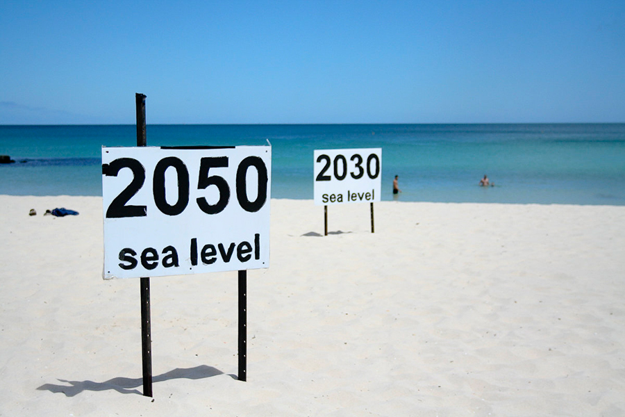
Some U.S. cities may be underwater by 2100 if carbon monoxide emissions are not reduced drastically, a new study revealed. Sea levels could rise up to 14 meters, as researchers say it is easier to determine how much the sea will rise, than to estimate when. Climate Central developed an interactive map that lets you see the different scenarios on U.S. cities.
Even if the U.S. reaches the emission levels that will be accorded in December at Paris’ climate talks, it won’t be enough to stop the flooding from happening in some major cities.
“I would avoid buying property in South Florida in particular,” Benjamin Strauss, lead author of the study, told the Thomson Reuters Foundation, according to the Christian Science Monitor.
Other regions like Coastal California, New York, and cities on the U.S. East Coast are also in possible danger, the study published in the journal Proceedings of the National Academy of Sciences suggests.
This type of inundation is called “locked in rise,” and it is caused by the energy in atmospheric CO2 that will be released as heat, raising the global temperature. This will modify water and weather cycles, altering the process, and will result into ice-melting. Researchers say that future emissions will determine the areas we can occupy or may have to abandon.
Sea levels are modified in several ways. Not only the volume of water melted from ice sheets contributes to the rise, but also the Antarctic and Greenland sheets that have a gravitational pull on the ocean, due to their massive size. That means that sea level is higher near those places, and the warmer the water, it becomes less dense, Strauss explains in the study.
Scientists say that the big question is: When will this happen? We have been assuming that sea level rise occurs at a rhythm of 2.3 meters over 2,000 years, but researchers warn that it will happen a lot faster than that.
“It is the best estimates we can make with the understanding that we have today about the processes leading to sea-level rise,” said Stefan Rahmstorf of the Potsdam Institute, although he didn’t participate on the study.
Strauss and his team developed a map that shows the contrast between a city with high carb-emissions and low emissions within a 100 years. In order to do that, the researchers analyzed and linked historical data with the emission numbers over the last years. He reported that one of the most astonishing things he found was that burning one gallon of gasoline means adding 400 gallons of water volume to the ocean.
Although linking these CO2 emissions with global warming and floodings isn’t something new, what it is important is that researchers show how your city will look like in a 100 years, instead of just throwing some numbers and statistics. It shows us how our decisions are going to affect directly the people living in the country in a near future. Nevertheless, there are a variety of ways in which cities may be able to adapt to the rising seas, like New Orleans with their 26-foot-high sea wall.
“If we don’t cut emissions we’re talking about losing American land [that’s] home to more people than live in any state, except for California and Texas. Home to more people than the state of Florida and New York,” Strauss warned.
Source: Proceedings of the National Academy of Sciences