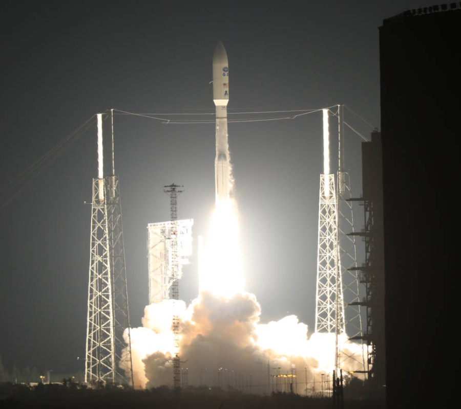
NASA launched the National Oceanic and Atmospheric Administration’s GOES-R satellite Saturday at 06:42 p.m. EST, beginning a new era for forecasting. NOAA’s Geostationary Operational Environmental Satellite-R is the first in a series of highly advanced satellites that will drastically improve timely forecasts, watches, and warnings.
GOES-R will collect data to help meteorologists to improve the quality of observation and prediction of local weather events. The satellite’s data will be primarily used by the National Weather Service in the hope of getting early warnings to guarantee public safety and protection of property. NOAA’s satellite was designed to detect thunderstorms, tornadoes, fog, volcanic eruptions and even hazards such as aerosol.
The advanced geostationary weather satellite will reach its final designated orbit in early December. Once in orbit, it will be renamed GOES-16. NOAA’s pioneer satellite will become fully operational within a year. GOES-R has to undergo a checkout and validation of its six instruments before it starts revolutionizing forecasting. The GOES-R Series operational lifetime will extend to December 2036.
NOAA manages the GOES-R Series Program through an integrated NOAA-NASA office. The National Aeronautics and Space Administration made possible the launch through its Launch Service Program based at the agency’s Kennedy Space Center in Florida. NASA used the United Launch Alliance Atlas V to put GOES-R in orbit and led the countdown. The NOAA-NASA program is comprised by staff from both agencies, and it is supported by industry contractors. The Joint Program is co-located at NASA’s Goddard Space Flight Center, GOES-R official website reports.
“The launch of GOES-R represents a major step forward in terms of our ability to provide more timely and accurate information that is critical for life-saving weather forecasts and warnings,” said Thomas Zurbuchen, an associate administrator for NASA’s Science Mission Directorate in Washington. “It also continues a decades-long partnership between NASA and NOAA to successfully build and launch geostationary environmental satellites.”
GOES-R Mission Overview: A new era for meteorological observation
The Geostationary Operational Environmental Satellite-R Series is the new face of geostationary satellites that will change how humans predict the weather. The GOES-R is the first of its series, and the next to come will be GOES-S, GOES-T, and GOES-U. NOAA’s innovative satellite series will guarantee improved forecasting for the United States up to 2036.
The series will generate data, including imagery and atmospheric measurements of Earth’s Western Hemisphere and space weather monitoring. GOES-R will provide within a year critical atmospheric, hydrologic, oceanic, climatic solar and space data that will revolutionize what we known about Earth’s meteorological constant changes.
GOES-R will observe thunderstorms, tornadoes, fog, floods, and even volcanic eruptions. NOAA’s new satellite will also detect forest fires and hazards such as aerosols to monitor the potential damages to Earth’s atmosphere and how they will affect weather. The GOES series and the data it collects will also serve for space weather, oceanography, drought outlooks and search and rescue missions.
NOAA’s geostationary satellite is capable of sending images of weather patterns and severe storms every 30 seconds, which would help protect assets in case of critical weather. GOES-R advanced instruments are responsible for the future upgrades of weather forecasts.
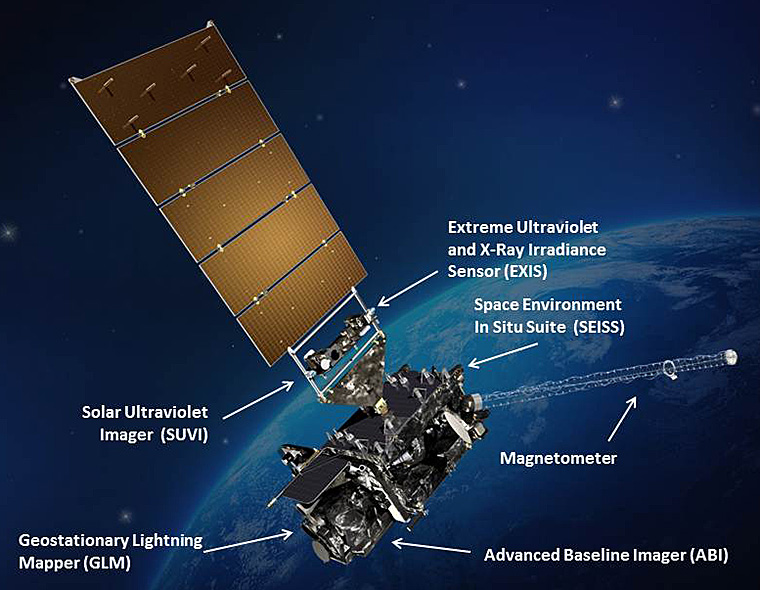
GOES-R includes Earth sensing, solar imaging, and space environmental measurements payloads. Its six main instruments are the Advanced Baseline Imager, the Extreme Ultraviolet and X-ray Irradiance Sensors, the Geostationary Lightning Mapper, the Magnetometer and the Space Environment In-Situ Suite. Data from GOES-R will provide 34 new or improved meteorological and space weather forecasting.
The Advanced Baseline Imager will provide images of Earth’s weather and oceans with 16 different spectral bands. Two will be visible channels, four near-infrared channels, and the other ten infrared channels. According to the satellite’s website, smaller public and private sector users can obtain GOES-R data through their Earth stations or through network distributions on Earth’s surface.
GOES-R series will also be part of the Search and Rescue Satellite-Aided Tracking (SARSAT) System, which is an international satellite-based search and rescue network operated by NOAA alone. The diverse use of the GOES-R series will translate into better prevention strategies to protect people and their properties, that ultimately will prevent economic and health crisis.
NOAA-NASA cooperation is vital to geostationary satellites
GOES-R is managed by two integrated NOAA-NASA project offices and an independent GOES-R Program Office. The joint offices are the Flight Project and the Ground Segment. The first one is in charge of the development of the space segment of the mission, including the spacecraft, the instruments, the launch vehicle and the auxiliary communication payloads.
The Ground Segments, on the other hand, oversees the facilities related to the mission, the antenna sites that will receive GOES-R information, the software and hardware for satellite command and the distribution of the satellite data to forecast agencies and others that need GOES-R information.
Source: GOES-R