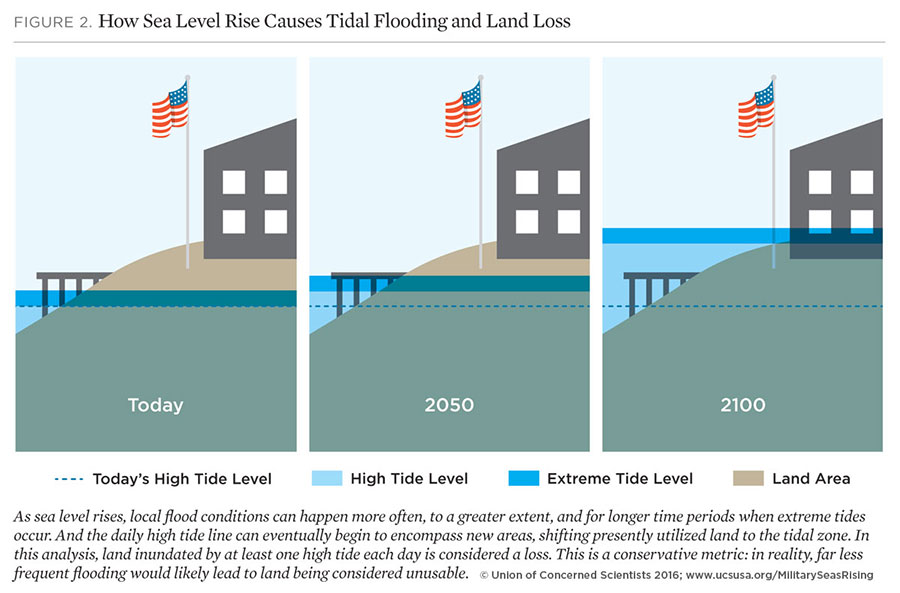
According to a report released by the Union of Concerned Scientists (UCS), 18 U.S. military bases are at risk of losing land and sea territory due to the rising sea levels.
Lead author Erika Spanger-Siegfried noted that there are already some installations that have to deal with floods whenever there is a high tide. The team measured the tide levels from Portland, Maine all along to Pensacola, Florida. The determining factor appears to be how fast the sea levels will rise for the remainder of the 21st century.
Most will be subjected to daily floods
The research team used 2050, 2070 and 2100 as points of reference as to when the climate change repercussions will hit.
It was determined that by 2050, half of the bases that were reviewed would experience at least 270 floods each year, compared to a yearly average of 10 as of 2016. Nine of the bases considered would face daily floods in the worst scenario.
The Naval Air Station Key West, Naval Station Mayport, the Marine Corps Recruit Depot Parris Island and Forts Eustis at Joint Base Langley-Eustis will most likely lose at least 20 percent of their surrounding terrain due to daily floods.
Then, by 2070, it was determined that half of the installations would flood over 500 times each year, resulting in more than one flood event per day. Any storm would produce heavy flooding on the reviewed bases.
By the end of the century, 8 out of 18 installations would lose 25 percent of their land due to the rise in sea levels, as 10 out of 18 bases would flood on a daily basis and a storm would flood almost every single one.
“Shockingly, these aren’t even the worst-case scenarios,” stated report co-author and UCS consulting scientist Kristy Dahl.
Coastal bases will increasingly lose land to rising seas in decades ahead: https://t.co/TpszqCDqtX pic.twitter.com/caQdvJYj5G #ActOnClimate
— Union of Concerned Scientists (@UCSUSA) July 27, 2016
Climate change vs. The US military
Some of the military bases have started to take action. Officers at the Dam Neck Annex in Virginia opted to build rock and sand dunes to protect the bases’ structures from floods. Personnel at the Langley Air Force Base, also in Virginia, built a shoreline seawall and dams to protect the infrastructure.
Spanger-Siegfried notes that the Pentagon has acknowledged the problem. Military bases cannot afford to lose parts of their structure, as they are located in strategic positions which allow them to perform an efficient and secure response. But she also stressed the fact that the measures implemented are not nearly enough to protect the sovereignty of the U.S. regarding its military bases.
Because anything that has to do with an assigned budget has to go through the Congress, the Pentagon has to go over the U.S.’s federal system of government in order to prepare its installations against the effects of climate change.
Scientists from UCS claim that there is a need for performing deeper and more detailed research. They suggest that Congress and the Department of Defense should invest in developing flooding and hurricane responses. These environmental changes will also affect surrounding communities, which is another national defense factor that eventually U.S. government officials will have to account for.
The military bases that the UCS deemed as prone to severe change due to climate change were as follows:
- Maine: Portsmouth Naval Shipyard
- New Jersey: US Coast Guard Station Sandy Hook
- Maryland: US Naval Academy
- Washington, DC: Joint Base Anacostia-Bolling and Washington Navy Yard
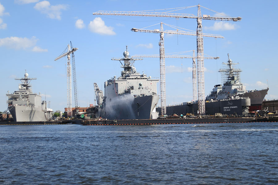
- Virginia: Joint Base Langley-Eustis | Naval Air Station Oceana Dam Neck Annex | Naval Station Norfolk
- North Carolina: Marine Corps Base Camp Lejeune
- South Carolina: Marine Corps Recruit Depot Parris Island and Marine Corps Air Station Beaufort
- Georgia: Hunter Army Airfield | Naval Submarine Base Kings Bay
- Florida: Naval Air Station Key West | Naval Station Mayport | Eglin Air Force Base
Rising sea levels, not a new concern
There is enough evidence to assert that the global sea level is rising at an alarming rate, and this will not likely change over the course of the 21st century. The studies show that until 1900, sea levels appear to have kept reasonably steady.
What causes global sea level to rise is the warming of the oceans and the decline of ice on the poles. Global sea level has increased 0.04 to 0.1 inches per year since 1900, but since 1992 it has increased 0.12 inches per year. Changes in sea level reveal relevant information about earth’s atmospheric and oceanic processes. To draft any long-term structural or strategic plan concerning the sea, the rise in sea level has to be a key factor in the calculations. This is reflected in the current study, where almost 20 U.S. military settlements will suffer intense flooding due to climate change.
Recently, NASA’s Operation IceBridge has made an effort to capture the melting of Arctic ice layers. It is the first time a large-scale map of the ice melt ponds has been achieved using sensitive data. The results of the research will show exactly how ice melts on the north pole, providing, even more, data supporting the rise in sea levels, which in turn puts 18 U.S. military bases in danger.
The apparent solution would be to allocate the sufficient budget so the Department of Defense could reinforce its structures to face global warming, but unless national priorities are set in the right order, there will not be a clear course of action to tackle the effects of global warming.
5 things you need to know today including how US coastal military sites could lose land to rising seas.#ActOnClimate https://t.co/Luw43wDB1z
— Ashley Siefert Nunes (@ashleysiefert) July 27, 2016
Source: UCS