The National Oceanic and Atmospheric Administration has published the first images obtained by the GOES-16 (former GOES-R) satellite launched on November 19, and they are just stunning.
The satellite officially named the Geostationary Operational Environmental Satellite-16, was launched from Cape Canaveral last year in collaboration with the Harris Corporation and using the Advance Baseline Imager technology.
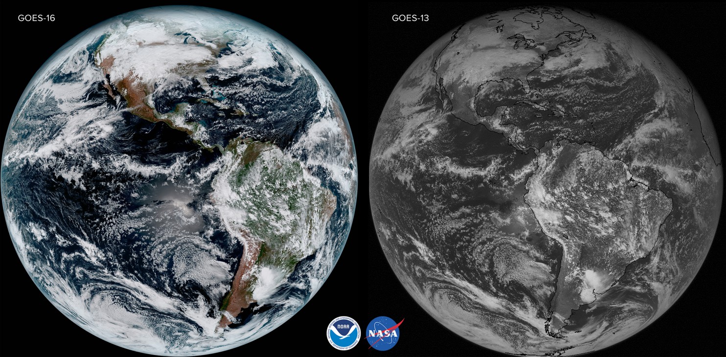
ABI is a high-resolution digital camera capable of capturing images at a one-tenth of a square mile resolution, which is almost four times superior to any technology present on the current imagers from several space agencies.
The objective for NOAA is to recollect important information concerning different weather events like “volcanic ash, dust, clouds, winds, fires, rainfall rate, and hurricane intensity.” This information could be detected in a time lapse of 30 seconds, ergo, about five times faster than current technology mechanisms.
According to the organization, this satellite is unprecedented as it is able to gather data that was inaccessible in the past and recollect it in record time.
“Once the satellite is fully operational, the resolution of the imagery taken from the Harris ABI will be comparable to seeing a quarter from a mile away,” said Eric Webster, vice president and general manager of Harris Environmental Solutions.
GOES-16 is a great photographer
Since last year, all the space-related scientific community has been anxiously waiting for pictures obtained by NOAA’s new satellite. According to the organization, the publication of these photos is the first step toward a new age concerning weather satellites.
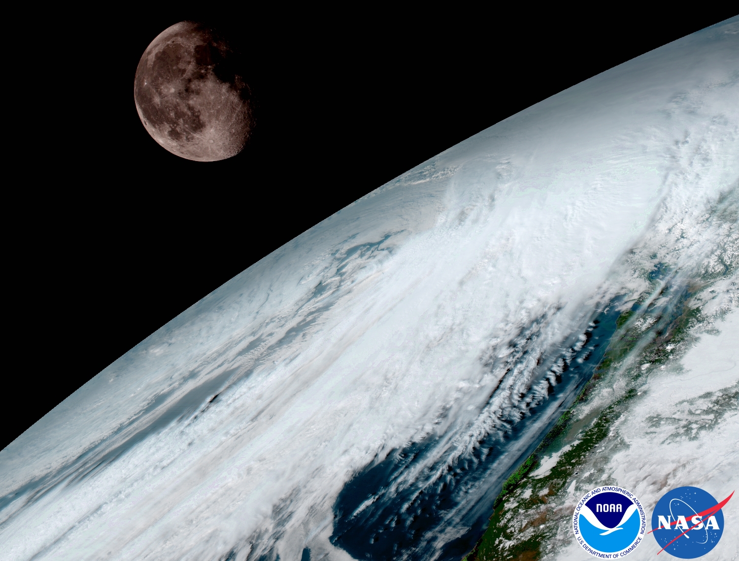
GOES-16 is currently located in a zone 22,300 miles above Earth where it can gather pictures from the Western Hemisphere. The space probe is capable of producing a full photo of Earth every 15 minutes, and scan the United States continental area in just 5 minutes.
According to NOAA’s official statement, this new technology will improve prediction capabilities, and therefore it will allow a more accurate forecast of the weather in different zones of the planet.
Stephen Volz, Ph.D. director of NOAA’s Satellite and Information Service, has said that GOES-16 is the most sophisticated satellite ever launched to space to recollect weather data, and he hopes that the information it can gather allows life-saving predictions in the near future.
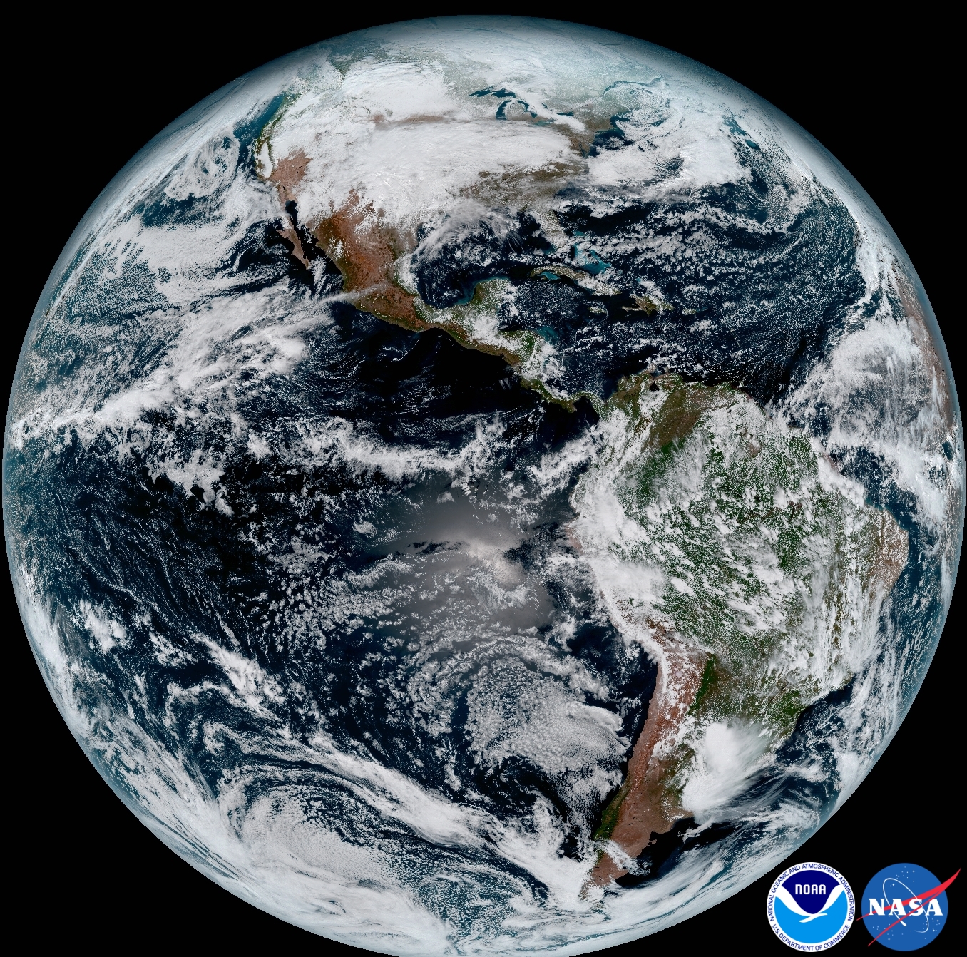
In one of the published photos, Earth can be seen at its finest. The color full-disk image was taken 1:07 p.m. ET on Jan. 15 using all the six instruments in GOES-16, as well as all 16 spectral channels available and the Advance Baseline Imager. The photo shows a full view of North and South America along with the oceans that surround those zones.
Currently, NOAA hopes to launch the GOES-S satellite, the fourth spacecraft from the GOES’ satellite series. The satellite is undergoing some experimental tests at Lockheed Martin’s Corporation facility in Littleton, Colorado. The testing would take about one full year to conclude, as environmental, mechanical and electromagnetic features must function correctly at all times.
Source: NOAA